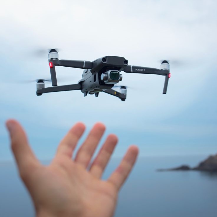
Emergence of High-Resolution Thermal Imaging
The year 2025 has seen remarkable progress in thermal drone camera resolution. This advancement is vital for various applications, as it allows for more detailed thermal imaging. High-resolution thermal cameras on drones now offer sharper images, making it easier to detect small temperature differences from a distance.
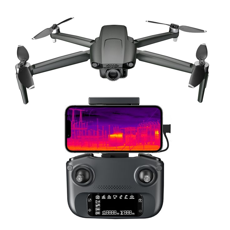
The benefits are numerous. In search and rescue operations, for example, high-resolution thermal cameras can pinpoint individuals in challenging terrains. For infrastructure inspections, these cameras can accurately identify potential faults in power lines or pipelines before they become critical issues.
Critically, this advancement has not come at the cost of operational efficiency. Despite the increase in resolution, thermal drone cameras have maintained, and in some cases even improved, their processing speeds. This means that users can collect high-quality data without facing significant delays.
Developers have achieved these improvements through a combination of better sensor technology and enhanced image processing algorithms. As a result, thermal drone cameras can now provide exceptional image quality, even in low-visibility conditions like smoke or fog.
These high-resolution thermal imaging capabilities have significantly expanded the use of thermal drone cameras across various sectors. They have become indispensable tools in public safety, agriculture, construction, and environmental monitoring, among others.
This leap in resolution reinforces the importance of keeping up with the latest trends and technologies in thermal imaging to stay ahead in the competitive market. As thermal drone cameras continue to evolve, their impact on operational effectiveness and efficiency can only be expected to grow.
Integration with Artificial Intelligence
The integration of artificial intelligence (AI) with thermal drone cameras has revolutionized their potential. In 2025, AI-enabled drones are smarter and more efficient. They can now automatically analyze thermal data in real-time. Here are some benefits AI brings to thermal drone technology:
- Autonomous Operations: AI allows drones to navigate and perform tasks without constant human input. This reduces the need for manual control and enhances the precision of flights.
- Advanced Pattern Recognition: AI algorithms are excellent at identifying patterns. They enable drones to detect issues like energy loss in buildings or locating people in search and rescue missions quickly.
- Predictive Analytics: By analyzing thermal data over time, AI can predict future problems in infrastructure. This helps in preventive maintenance and reduces unexpected failures.
- Efficient Data Processing: With AI, the immense volume of data captured by thermal cameras is sorted and analyzed promptly. This means quicker decision-making for users.
If we take search and rescue as an example, AI coupled with thermal drone cameras can mean the difference between life and death. The AI systems can sift through thermal images to locate individuals by detecting body heat against the cool background. This directly increases the success rate of rescue missions.
In agriculture, AI-powered thermal drones can monitor crop health. They assess temperature patterns to detect stressed plants, allowing farmers to take action sooner.
The keyword ‘thermal drone camera’ goes hand in hand with AI in the modern era. As AI continues to evolve, we can only anticipate even greater advancements in thermal drone capabilities and applications.
Enhanced Battery Life and Flight Time
A game-changer for the thermal drone camera market in 2025 is the extended battery life and flight time. Here’s how these factors contribute to operational superiority:
- Longer Missions: With enhanced batteries, drones can fly longer without needing a recharge. This is key for missions that require extensive surveillance.
- Reduced Downtime: Longer-lasting batteries mean less time spent recharging. Operators can focus more on data analysis and less on power management.
- Extended Reach: Drones with more flight time can cover larger areas. This is vital for mapping vast lands or monitoring extensive infrastructure.
The combination of advanced energy storage technologies and more efficient power usage has led to this milestone. Users can now deploy drones over prolonged periods, making them far more useful for a variety of tasks.
For search and rescue, extended battery life ensures that drones stay in operation throughout critical missions. In agriculture, extended flight time means larger fields can be covered in a single flight, optimizing crop management.
Every sector that relies on thermal drone cameras benefits from this advancement. From public safety to environmental monitoring, the implications of improved battery life and flight time are significant. They offer more reliability and flexibility, enhancing overall efficiency in thermal drone operations.
Compact and Lightweight Design Innovations
In 2025, thermal drone cameras have seen significant design innovations. More compact and lightweight, these cameras make drones easier to handle and deploy. Here are a few standout improvements:
- Smaller Form Factor: The latest cameras boast a reduced size. This makes drones less bulky and more agile in flight.
- Weight Reduction: Advanced materials have trimmed down the weight of cameras. This contributes to better flight dynamics and longer flight times.
- Enhanced Portability: With the smaller and lighter cameras, transportation of drones to remote locations has become easier. This is critical for quick deployment in emergency scenarios.
- Increased Drone Variety: Lighter cameras expand the range of compatible drones. Now, even smaller drone models can carry advanced thermal imaging technology.
These innovations in design not only broaden the application of thermal drones but also improve user experience. A lighter thermal drone camera can lead to more robust and longer-lasting operations. Spaces once considered too tight for drone access are now open for exploration and data collection. As a result, industries that require precision and portability, such as wildlife tracking or urban surveillance, are experiencing a surge in the use of thermal drone cameras.
Improvements in Real-Time Data Processing
Advances in 2025 have massively boosted the real-time data processing of thermal drone cameras. These improvements encompass several key areas:
- Speed Enhancement: Thermal drone cameras now process data faster than ever. This allows for instant analysis and decision-making.
- Streamlined Workflows: With the new systems in place, processing workflows are more efficient. They support rapid data turnover, vital for time-sensitive tasks.
- Increased Accuracy: Faster data processing does not compromise on detail. Users enjoy both speed and precision in the thermal images they receive.
- Edge Computing: Integration of edge computing means data is processed on the drone. This reduces the need to transmit large amounts of data for analysis.
- Machine Learning Integration: Machine learning algorithms further refine data processing. They learn from previous datasets to process new information more accurately.
These improvements mean that professionals in sectors like public safety and agriculture can now rely on up-to-the-second data from their thermal drone cameras. Quick and accurate thermal data processing is essential for effective monitoring and fast responses to changing conditions. This year, users experience this cutting-edge capability, offering a glimpse into what the future holds for thermal imaging technology.
Expanded Application in Various Industries
The year 2025 has seen thermal drone camera use soar across multiple industries. Each sector recognizes the tech’s capacity to boost outcomes and streamline operations. Here are some industry-specific applications:
- Agriculture: Farmers use thermal drone cameras for soil health checks and irrigation planning. The ability to monitor crop temperatures aids in spotting disease and stress early.
- Construction: In construction, these cameras spot structural issues from above. They check for insulation gaps and water damage without the need for scaffolding.
- Energy: Energy companies inspect solar panels and wind turbines. They quickly find hot spots indicating equipment failure or inefficiency to prevent outages.
- Environmental Monitoring: Conservationists track animal populations and monitor forest health. The cameras detect changes in environmental conditions that could signal an issue.
- Public Safety: Law enforcement and search teams find missing persons faster. Thermal feeds spot suspects or victims by their body heat, night or day.
- Insurance: Adjusters assess property damage with precision. They evaluate claims more efficiently, saving time and reducing fraud risk.
The adaptability of thermal drone cameras has transformed them into versatile tools. Their deployment saves time and boosts accuracy in critical operations. With each passing year, we expect even broader adoption across new and unforeseen sectors.
Advancements in 3D Thermal Mapping
The landscape of thermal imaging has undergone a dramatic evolution with the introduction of 3D thermal mapping by thermal drone cameras in 2025. This exciting development offers a more comprehensive analysis of environments and objects. Here’s why 3D thermal mapping is a significant step forward:
- Improved Depth Perception: Thermal images now come with an added dimension of depth. This allows for better understanding of the spatial relationship between different temperature zones.
- Greater Detail Accuracy: With 3D mapping, subtle thermal variances are more distinguishable. Users can pinpoint exact locations of heat sources or losses.
- Enhanced Analytical Data: The 3D models produced from thermal images provide richer data sets. This aids in complex analyses needed for various industries.
- Superior Visualization: The 3D aspect makes interpreting data easier and more intuitive. It supports professionals in making faster and more informed decisions.
Industries ranging from archaeology to urban planning are benefiting from this technology. In archaeology, 3D thermal mapping reveals hidden structures and artifacts with temperature variations. Urban planners use it to design more efficient cities by studying heat distribution patterns.
Overall, 3D thermal mapping using thermal drone cameras represents a leap in the capabilities of thermal imaging. Its impact on operations across diverse fields shows just how versatile and powerful this technology has become in its ability to offer new perspectives and insights.
The Rise of Multi-Sensor Drone Cameras
2025 has marked a significant milestone with the emergence of multi-sensor thermal drone cameras. These advanced devices combine several types of sensors, enhancing the capabilities and applications of drones in various settings. Let’s dive into the benefits and applications of these innovative multi-sensor systems.
Multiple Data Streams
Multi-sensor cameras are equipped to gather various types of data simultaneously, which significantly enhances the information available to users. This capability means that operators can capture different aspects of an environment or target area in real-time. For instance, while monitoring an agricultural field, a multi-sensor camera can simultaneously collect visual images, thermal readings, and even chemical signatures. By integrating these data streams, users gain a more complete and nuanced understanding of the scene, allowing for more informed decision-making and effective action.
Enhanced Detection Capabilities
One of the key advantages of multi-sensor cameras is their enhanced detection capabilities. Unlike traditional cameras that primarily capture visual data or heat signatures, these advanced devices can acquire a wide range of spectral data. This includes not only infrared images but also ultraviolet and other wavelengths, enabling comprehensive analysis of a situation. For example, in wildlife monitoring, while thermal imaging may reveal the presence of animals, visual data ensures identifying species, age, and health, thereby providing a richer dataset for analysis.
Time-Saving
The time-saving benefits of using multi-sensor drone cameras cannot be overstated. By collecting multiple types of data in a single flight, operators can complete complex missions more efficiently. This capability eliminates the need for multiple trips to gather various types of information or for switching between different drones equipped with specific sensors. Consequently, efficiency is maximized, resulting in quicker project turnaround and allowing operators to allocate their time and resources more effectively.
Cost-Effective
From a budgetary perspective, multi-sensor drone cameras present a more cost-effective solution for many organizations. By reducing the necessity for several specialized drones—each dedicated to capturing a specific type of data—users can significantly lower their overall equipment expenditures. Additionally, these multi-functional systems can decrease maintenance costs and operational expenses associated with managing a fleet of drones. Ultimately, investing in a multi-sensor drone camera can lead to substantial financial savings while improving data collection capabilities.
Improved Situational Awareness
In public safety scenarios, having access to both visual and thermal feeds concurrently offers enhanced situational awareness. For instance, during firefighting operations, first responders can monitor heat signatures and visual cues to navigate towards potential hazards, locate victims, or understand the fire’s spread. This combination of data helps teams devise better strategies, respond to emergencies more effectively, and ultimately save lives. Improved situational awareness can be pivotal in critical missions, influencing their success and safety.
Versatile Monitoring
Multi-sensor cameras also provide versatile monitoring applications, particularly in sectors like agriculture. By combining visual and thermal sensors, farmers can perform simultaneous monitoring of crop health and irrigation needs during a single flight. This dual capability allows for real-time assessments of water stress in crops, identification of pest issues, and evaluation of overall field conditions. By leveraging this integrated approach, agricultural professionals can make well-informed decisions, optimize resource usage, and enhance overall productivity.
This technology stands out as a versatile solution for comprehensive data collection and analysis. The rise of multi-sensor thermal drone cameras continues to push the boundaries, offering even more potential for industries to harness the power of advanced aerial surveillance and inspection tools. With this innovation, thermal drone cameras gain even more utility, becoming more integral than ever to operations across a myriad of sectors.
Conclusion
In summary, the advances in thermal drone camera technology for 2025 present exciting possibilities for various sectors. As these cameras offer innovative solutions for heat detection, aerial surveillance, and more, their contributions to efficiency and safety cannot be overlooked. Ultimately, individuals and industries that embrace this cutting-edge technology will reap the benefits, leading to enhanced decision-making and improved operational outcomes. By exploring the capabilities of thermal drone camera, one can harness their true potential in today’s fast-paced environment.